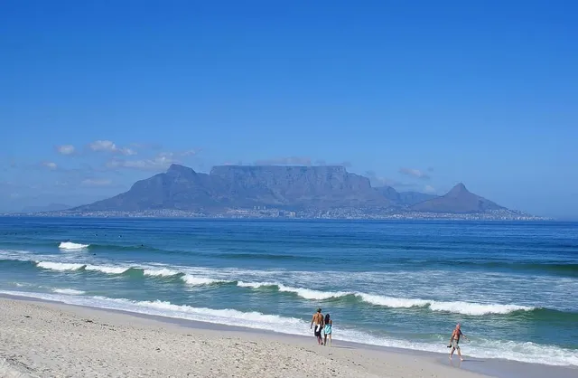
Ask a child to draw a mountain and you’ll get a triangle. Table Mountain ignores the brief entirely: a sheer-walled block above Cape Town whose summit runs dead level for about three kilometres (2 mi), as if something planed the top off. It’s the rare world-famous peak defined by a missing summit — and the reason why Table Mountain is flat turns the usual story of how mountains get their shapes inside out.
Table Mountain is flat because its summit is a single slab of extremely hard, 450- to 510-million-year-old quartzitic sandstone. Softer rock layers that once lay above it were stripped away by erosion, leaving an erosion-resistant platform about 3 km (2 mi) from side to side — an ancient valley floor now standing high above Cape Town.
Why Table Mountain is flat: the hard-layer story
Most dramatic peaks are shaped by what erosion builds: glaciers gnawing a summit into a horn, or a volcano stacking a cone. Table Mountain is shaped by what erosion couldn’t remove. Its upper mass is Table Mountain Sandstone — a quartzitic sandstone laid down in flat sheets on the sea floor during the Ordovician, some 450 to 510 million years ago, resting on a base of older Cape Granite with a band of maroon Graafwater mudstones between.
Quartzitic sandstone is brutally resistant stuff. As hundreds of millions of years of weather worked the region down, the softer rocks above and around this layer surrendered and washed away, while the hard slab endured. What survives today is essentially the underside of a vanished landscape: geologists describe the summit plateau as a syncline — a downfolded former valley floor — whose flanks have eroded off, leaving the one indestructible layer standing proud. The flat top isn’t a summit that was flattened; it’s a flat rock sheet that was exposed, still lying at the gentle angle it was deposited in.
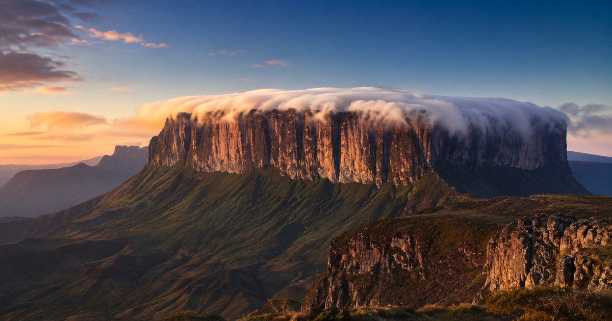
The same logic explains the mountain’s architecture in profile: near-vertical cliffs where the hard slab breaks off at its edges, and a level skyline between them. Mesas and buttes the world over — from the American Southwest to Venezuela’s tepuis — follow the recipe: hard cap, soft surroundings, patience.
The numbers on the table
Flatness makes the mountain’s statistics pleasingly strange. The highest point isn’t a peak at all but a barely perceptible rise near the eastern end of the plateau, marked by Maclear’s Beacon — a stone cairn built in 1865 by the astronomer Sir Thomas Maclear for a trigonometrical survey — at 1,086 m (3,563 ft) above sea level. The famous upper cable station at the western end sits slightly lower, and most visitors never notice the summit “climb” between them, because it amounts to a stroll across a rock garden.
Modest height, though, buys outsized presence. Rising close to the Atlantic shoreline with about 1,068 m (3,504 ft) of prominence, the mountain fills Cape Town’s sky the way peaks three times its elevation fill theirs — a tidy demonstration that relief you can see matters more than altitude on paper. Alongside the volcanic cones and glacial horns, its dead-level silhouette has earned it a place among the most recognizable mountains on Earth: there is no second guess for a three-kilometre tabletop above a harbour city.
The tablecloth: weather performing geology’s shape
Table Mountain’s most theatrical trick is meteorological. When the southeasterly wind — Cape Town’s famous summer “southeaster” — drives moist air up the mountain’s slopes, the air cools until its moisture condenses into an orographic cloud that settles over the plateau and pours down the northern cliffs, evaporating as it sinks into warmer air. Capetonians call it the tablecloth, and local legend blames a smoking contest between the devil and a Dutch pirate named Jan van Hunks.
The tablecloth only works because the top is flat. On a pointed peak the same process makes a small cap or banner cloud; here the level plateau lets the cloud spread into a smooth white sheet draped precisely to the table’s edges. Shape drives weather, and weather then advertises the shape — you can identify the mountain from the behaviour of its cloud alone.
The table doesn’t stand entirely alone, which is useful for orientation. Two companions flank it in the classic city view — Devil’s Peak to the east and the domed Lion’s Head to the west, both carved from the same layered Cape rocks — and together the trio makes the skyline unmistakable from land, sea or air. If you’re trying to work out which way you’re facing in a Cape Town photograph, the tabletop plus its two pointed neighbours is as good as a signed caption.
Reading flat-topped mountains anywhere
For peak-spotters, Table Mountain is the archetype of a whole identification category. When a skyline shows you a long, level summit with steep or stepped walls, you’re almost always looking at layered sedimentary or volcanic rock capped by a resistant sheet — a mesa, plateau or tabletop — rather than the cones and pyramids that folded and volcanic ranges produce. The silhouette vocabulary matters: a horn says glaciers carved it, a smooth cone says eruptions built it, and a table says erosion peeled a landscape away and left the toughest page of the book. Our guide to identifying a mountain by its shape walks through the full set.
And when a flat-topped skyline stumps you anyway — plenty of lesser tabletops ring the Cape, and mesas crowd half the world’s drylands — point the app at it. It will name the massif, give you its height and prominence, and settle whether you’ve found the original table or one of its many imitators.
The real peaks
Genuine photographs of the summits above — so you know what to actually look for: